Historypin – Make DBQs with a Digital Time Machine That Layers Image, Story and Location

While planning for my next document based question (DBQ) workshop, I discovered Historypin. It’s a great mashup of digital photos with stories layered over Google maps. Users can search images by geography / time and post historic photos with stories to maps. It’s fascinating to view historic photographs set against the backdrop of current Google map street view.

Historypin

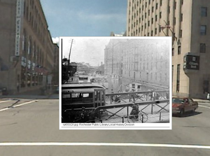
Here’s a circa 1894 photo I uploaded to Historypin showing a bridge crossing the Erie Canal in downtown Rochester NY. It’s layered over a functioning “street view” in Google maps.

In Historypin’s story section, I provide a brief history of the canal’s impact on the growth of the city.

Then I pose a question. “I wonder if the people in the old photograph still appreciated the canal’s role in creating the city of Rochester, or if they had come to see it as outmoded nuisance which divided the city in half?”

For more ideas for classroom see:  image guide | story guide | teachers’ notes

What I like most about Historypin is that it adds a new dimension to the DBQ approach to instruction – students don’t simply learn from historic documents – they get to document their world for future generations.

More from Historypin:

Historypin was created as part of our current campaign to get people from different generations spending more time together. From a lot testing, we found old photos are a great way of getting people talking about how their street used to look, what their grandparents were like and what’s changed (or not) over time. 

We decided to create a website where people everywhere could share their old photos and the stories behind them, pinning them to a map of the world. We also thought it would be neat if you could compare these old photos with how the world looks today, making the site a bit like a digital time machine. So we asked Google if they’d help. They let us use their map and Street View functionality and helped us build the site. 

The great thing about Historypin is that when they’re using the site, loads of people are spending time with someone from a different generation. Older people have attics full of old photos, younger people know when to click and when to double click.
Homefront America – Engage Students with Document Based Essential Questions

Update: October 2012: While this lesson is still available as a pdf (see original post below) an expanded version – Why We Fight: WWII and the Art of Public Persuasion - is now available at iBookstore It includes 43 historic posters, 13 rare films, plus numerous communiqués, photographs and recordings. Plus student “stop and think” prompts based on CCSS skills. 

Ride-hitler Recently my post: Essential Question: Who is the Teacher in Your Classroom? drew a response from a teacher looking for a more scaffolded approach to document based instruction. Here’s my response …

Homefront America in WW II (PDF) is designed to improve content reading comprehension with an engaging array of source documents – including journals, maps, photos, posters, cartoons, historic data and artifacts. (One of the central goals of the Common Core standards).
I developed it to serve as a model for blending essential questions, higher order thinking and visual interpretation. I intentionally refrained from explaining the documents, to afford students the chance to do the work of historians. A variety of thinking exercises are imbedded in the lesson to support reading comprehension. Graphic organizers support differentiated activities to assist the students in extracting meaning from the documents.

Hopefully this lesson serves as a model of how to infuse support for literacy into the more typical educational goal of content mastery. But more importantly, it is designed to demonstrate how student engagement can be “powered” by an essential question. 

Instead of attempting to teach the American homefront experience during WWII via the memorization of historical facts (like “victory” gardens), this lesson approaches the same subject through a more timeless question “How did Americans change their lives to support the war effort?”

This essential question invites the students into the material as they draw from their life experience to construct a response. Guiding questions direct students to construct comparisons between the American experience in WWII and the Iraq / Afghanistan war. Moreover, since the events of September 11th, the very notion the “homefront” has been redefined by new perceptions of terrorism and homeland security. 

Instruction is not simply an act of telling, it should instead be centered around creating learning experiences that provoke student reflection. In this lesson, source documents and literacy strategies combine to simultaneously teach content and comprehension. But more importantly, an essential question serves as a springboard to engage students in a deeper reflection on the notion of sacrifice in the historical context and in their own lives.

Scaffolding questions include …

Pre Reading / Think Before You Start: 

Before you begin this lesson,think about and discuss in small groups the following questions: 

  • What resources are needed to wage a war? 
  • How could people on the home front help to supply these resources? 
  • What would you be willing to contribute to a war effort? 

Post Reading / The Question Today: 

Civilians have always been impacted by war and they are frequently called upon to contribute to national war efforts. Since the events of September 11, 2001, the United States has fought wars in Afghanistan and Iraq. 

  • How have Americans on the homefront contributed to the effort? What have they sacrificed?
  • How do those efforts compare with the home front in WWII? 
  • How did the attacks of September 11 change the nature of the “homefront?”

How to Become a Teacher: Resources for Certification and Interviews

It’s been 40 years since I set my goals to become a teacher. (You might be amused by my blog post on the 1971 evaluation of my student teaching) Fortunately today there are some great online resources to assist you. Here’s two that impress me.
CertificationMap

certification map-featured

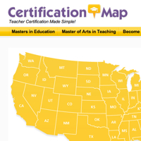
Teacher certification requirements vary greatly by state and are often difficult to understand. A new website, CertificationMap informs future teachers about the requirements for certifications in every state.  It’s sponsored by MAT@USC, a Master of Arts in Teaching program delivered online from the University of Southern California. I tried it out and found it to me much more user friendly than the individual state Department of Education websites.
Click on a state link and you’ll find salary statistics, prerequisite coursework, steps to teacher preparation, testing, and useful links for teaching in that state. If you would like additional information, you can input your email and phone number. I tried it out, expecting not much more than to be solicited by USC.
I did get a very welcome surprise when I was called two days later by Nicole Dillard, a counselor at the USC’s Rossier School of Education. She was more than willing to use her state-by-state database to supply me with additional information not found on CertificationMap regarding certification requirements. Of course, she also explained the merits of USC online certification program and noted that in the site’s first two months it had generated nearly 300 interested leads for the program. Bottom line – try CertificationMap and feel free to give your contact info without fear of the hard sell.
Road to Teaching
A second site I’d like to recommend to folks interested in a teaching career is: Road to Teaching: Resources for Aspiring, Student, and Beginning Teachers. It’s a site written by teachers for new and aspiring teachers. Here’s their overview:

A cadre of dedicated educators, known as star contributors, have committed to providing support to student teachers. These star contributors will answer your questions, address your concerns, provide advice, and give encouragement. There are several ways to connect with a star contributor. You can (anonymously) post a comment or blog by joining Road to Teaching. If you prefer to email a specific question (e.g. content related question) to any of our star contributors, please feel free.

One of their most popular posts is Teacher Interview Questions. It contains an impressive array of questions, many with sample answers. It’s well worth a visit before that next interview. Road to Teaching also includes valuable links and the chance to dialogue with others who are starting their teaching careers.

First Google Map Discovered – Created in 1652

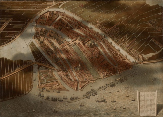
I enjoy looking at historic maps and other visual displays of information. I was browsing online images from the National Gallery of Art’s current exhibit “Pride of Place: Dutch Cityscapes of the Golden Age” and was startled to see  “A Bird’s-Eye View of Amsterdam” painted (around 1652), by Jan Micker.

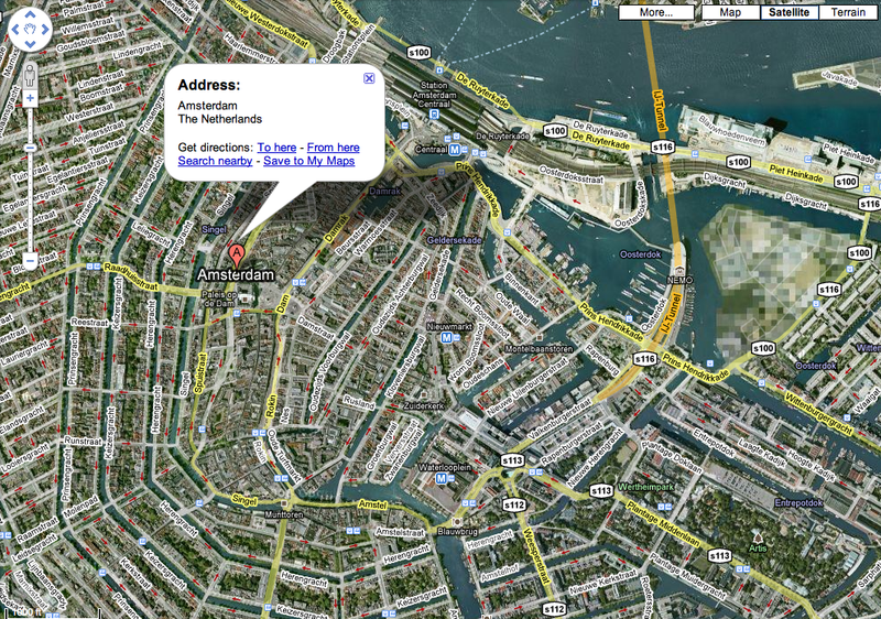
Micker’s work certainly parallels the Google Map satellite view. Especially noteworthy are his realistic depiction of details, shadows of clouds and the large key with drop shadow in the lower right corner. Not bad considering he lacked an aerial perspective. He was inspired by a similar work (minus shadows) from 1538 by Cornelis Anthonisz. 

Below is a current Google Map of Amsterdam for comparison. 
Note: the Google maps faces north. Micker’s view faces south.
Click map to enlarge or go to Google map of Amsterdam 

Google

European DBQ Source Goes Digital

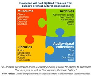
Europeana Interested in source material for your European history DBQ's? Paintings, music, films and books from Europe's galleries, libraries, archives and museums. 
The new European Commission's Europeana digital library project has been launched with 2 million digital documents including paintings, audio files, maps, videos and other artifacts at http://www.europeana.eu