The Detroit Eight Mile Wall is a one-foot-thick , six-foot-high separation wall that stretches about 1⁄2 mile. It was constructed in 1941 to physically separate Black and white homeowners on the sole basis of race. The wall no longer serves to racially segregate homeowners and, as of 1971, both sides of the barrier have been predominately Black. Photo by John Vachon / Library of Congress
This is repost of a lesson I did in my social studies methods class at University of Portland. It explored the largely forgotten government policies that segregated nearly every major American city and metro area. We also looked at how those unconstitutional actions fostered inequality in America since their enactment in the 1930s.
Scroll down for student projects.
In preparation for this class,
students watched the video Segregated by Design.
class session – via Zoom
Class opened with the brief film Housing Segregation and Redlining in America: A Short History. I then put students into breakout groups and (using a Jamboard) they created mind maps of the legacy of redlined neighborhoods based on what they had seen in the two introductory videos. They brainstormed and developed visual comparisons that explored multiple factors such as – income, wealth, health, schools, policing, services, employment, environment.
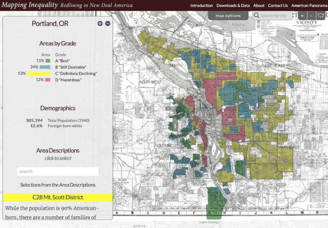
Next I introduced the tools they would use for the lesson – digitized version of 1940 US Census and the website Mapping Inequality: Redlining in New Deal America . Mapping Inequality allows the user to explore the “redline” maps created by agents of the federal government’s Home Owners’ Loan Corporation (HOLC) between 1935 and 1940. The maps are displayed over contemporary maps that make it easy to view where redline districts are today.
Next I took them to the the 1940 US Census and showed them how to look up street addresses and navigate to specific neighborhoods. I shared census pages from some Portland neighborhoods.
Sample “Best” and “Hazardous” neighborhoods
“Best” A7 Arlington Heights District- Census page from 229 SW Wright Ave. in A7 | 229 SW Wright Today
Clarifying Remarks from HOLC map: Deed restrictions have expired but single-family residential zoning and topography give ample protection. Infiltration of Subversive Races is remote. Foreign-born families: 0% Negro: none. Residents: Executives, business and professional men, retired capitalists, etc.
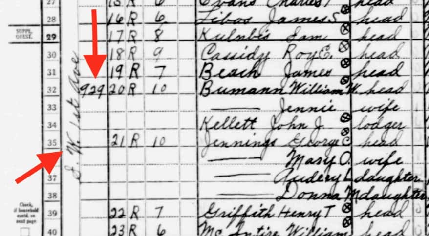
“Hazardous” D8 Southwest River District – Census page from 931 SW 1st Ave in Portland in D8. | Rooming house torn down. 931 SW 1st is now the World Trade Center
Clarifying Remarks from HOLC map: This is distinctly a workingmen’s rental district and approximately half of the population being employed in the industrial plants along the river.
Infiltration of Subversive Races has occurred. Foreign-born families 35%; Orientals 750 Chinese, 250 Japanese, 35 Filipinos, Negro 30%
How to search in Census of 1940
Note: it helps to refer to Blank 1940 Census form showing categories
You will “search by location where the person lived.” Begin by narrow search by state, county, city, street.
After you click search, you have the option to add a cross street.
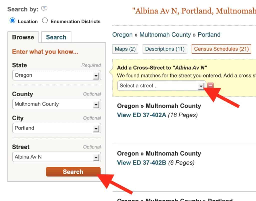
It will take you to multipage document that may not exactly zero in on the intersection you wanted. You may need to scroll through some pages to get to that location. You can find the streets and house numbers on far left. (Street written vertically)
The assignment
I wanted the student to draw a personal connection between the HOLC categories (best, still desirable, definitely declining and hazardous) and the data from the 1940 census. To demonstrate, I shared my mother’s family entry from 1940 census then showed that my grandparents and family were living in a HOLC designated “Definitely Declining” neighborhood. I shared some family photos of the house and neighborhood. Then we looked at the family home value in 1940 and shared how the neighborhood had steadily declined to the point that the home today is currently valued at less than one-half of the inflation-adjusted value listed in the 1940 census.
I knew that not all students would be able to find a family listing in the census nor might they ever have lived in a city mapped by HOLC. So I left the final product very open ended and invited them to make connections that worked for them.
Sample student work
A number of students were able to find family members on the census and family home in the HOLC maps
A few students focused on the history of homes they lived in.
Some students looked how the HOLC influenced residential options for immigrant groups
Others looked at redlining’s impact on property values and neighborhood development
