Exploring History Vol IV: Eight Document Based Lessons

I’m very pleased to share a new iBook just published by my Social Studies Methods class at the University of Portland.

Interactive iBook version free at iTunes.
Static pdf version (5 MB)

It features eight engaging questions and historic documents that empower students to be the historian in the classroom. The units draw from a fascinating collection of text and multimedia content – documents, posters, photographs, audio, video, letter and other ephemera. “Stop-and-think” prompts based on CCSS skills guide students through analysis of the primary and secondary sources. Essential questions foster critical thinking. All documents include links back to the original source material so readers can remix the content into their own curated collections.

All of my student’s wrote for a public audience on our class blog and persued three class goals:

  • Learn to think like a historian.
  • Become a skillful instructional designer
  • Develop technical skills for production, reflection, growth and professional networking.

The lesson design process began early in the semester when students designed lessons in historical thinking skills based on the work of Sam Wineburg and the Stanford History Education Group (SHEG). They focussed on three key skills – Sourcing, Contextualizing and Corroborating. Then students identified essential questions worth answering and gathered documents to explore the question in an extended lesson design process.

Exploring History: Vol IV was our PBL capstone and is available on iTunes in 51 countries around the world. Here’s a post (from fall ’13 class) that describes our project workflow (including how we utilized iBooks Author). Here’s Exploring History: Vol I created by my fall 2013 class. And Exploring History: Vol II designed by my fall 2014 class. Exploring History: Vol III created by my fall 2016 class

I’ll be doing a future blog post that features each student’s DBQ, but for now here’s the US and World History lessons in chronological order:

  1. Mysterious Bronze Age Collapse by Sam Hicks
  2. From Revolution to Government by Valerie Schiller
  3. Imagination, Innovation & Space Exploration by Molly Pettit
  4. The Real Romanovs by Kelly Marx
  5. World War I: The Human Cost of Total War by Anna Harrington
  6. Collectivization and Propaganda in Stalin’s Soviet Union by Clarice Terry
  7. Holy Propaganda Batman! by Karina Ramirez Velazquez
  8. The Nicaraguan Literacy Crusade by Scott Hearron

A History of Fear: KKK Kamp 1924

  • kkkcamp1
  • kkkcamp2
  • kkkcamp3
  • kkkcamp4
  1. 1
  2. 2
  3. 3
  4. 4


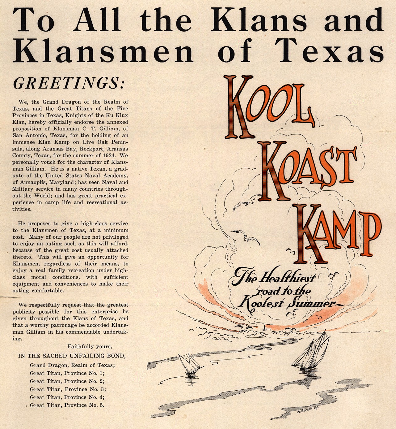
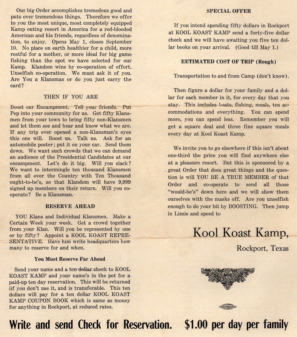
“To All the Klans and Klansmen of Texas Greetings:
Kool Koast Kamp. The Healthiest road to the Koolest Summer.”

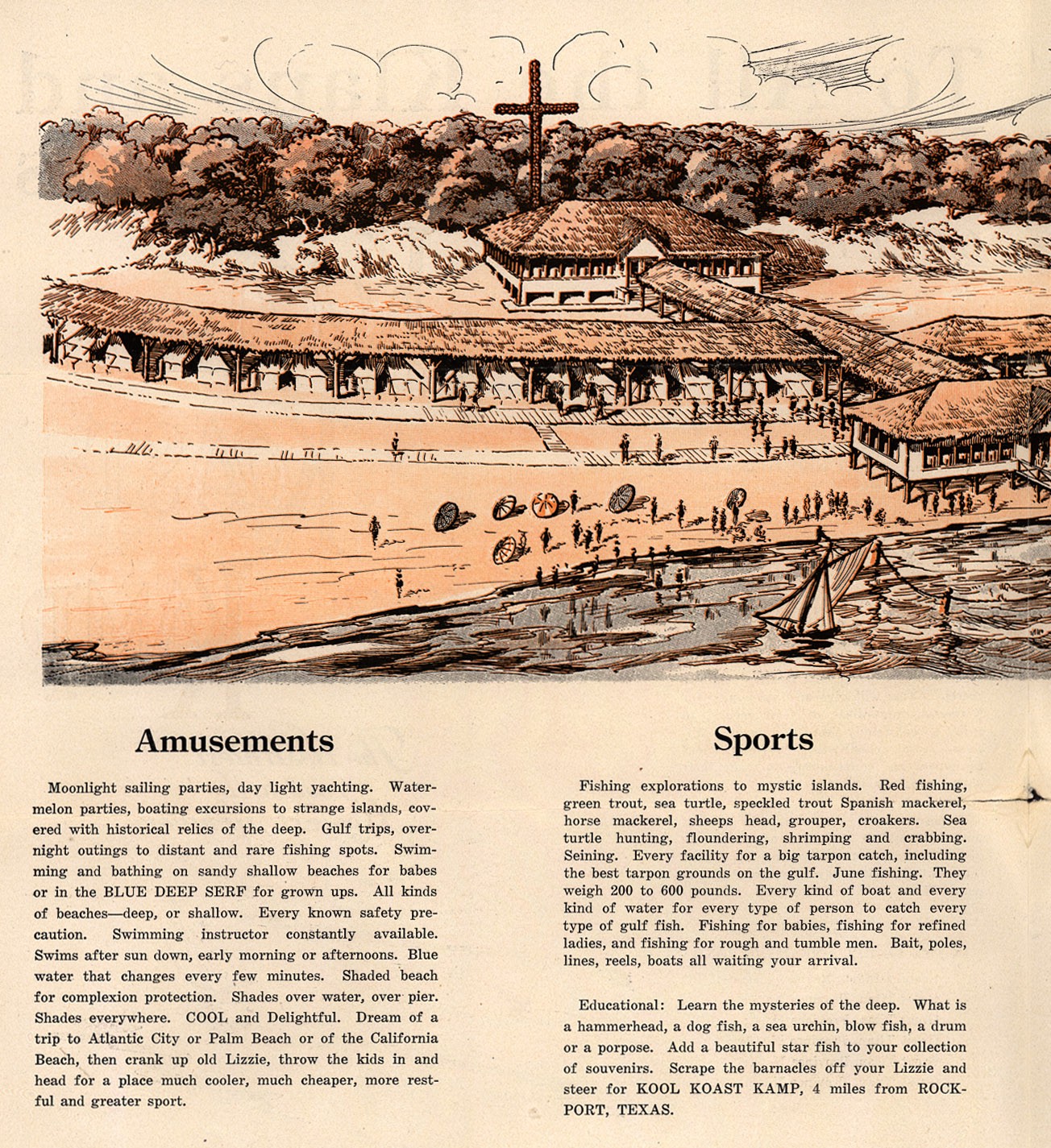
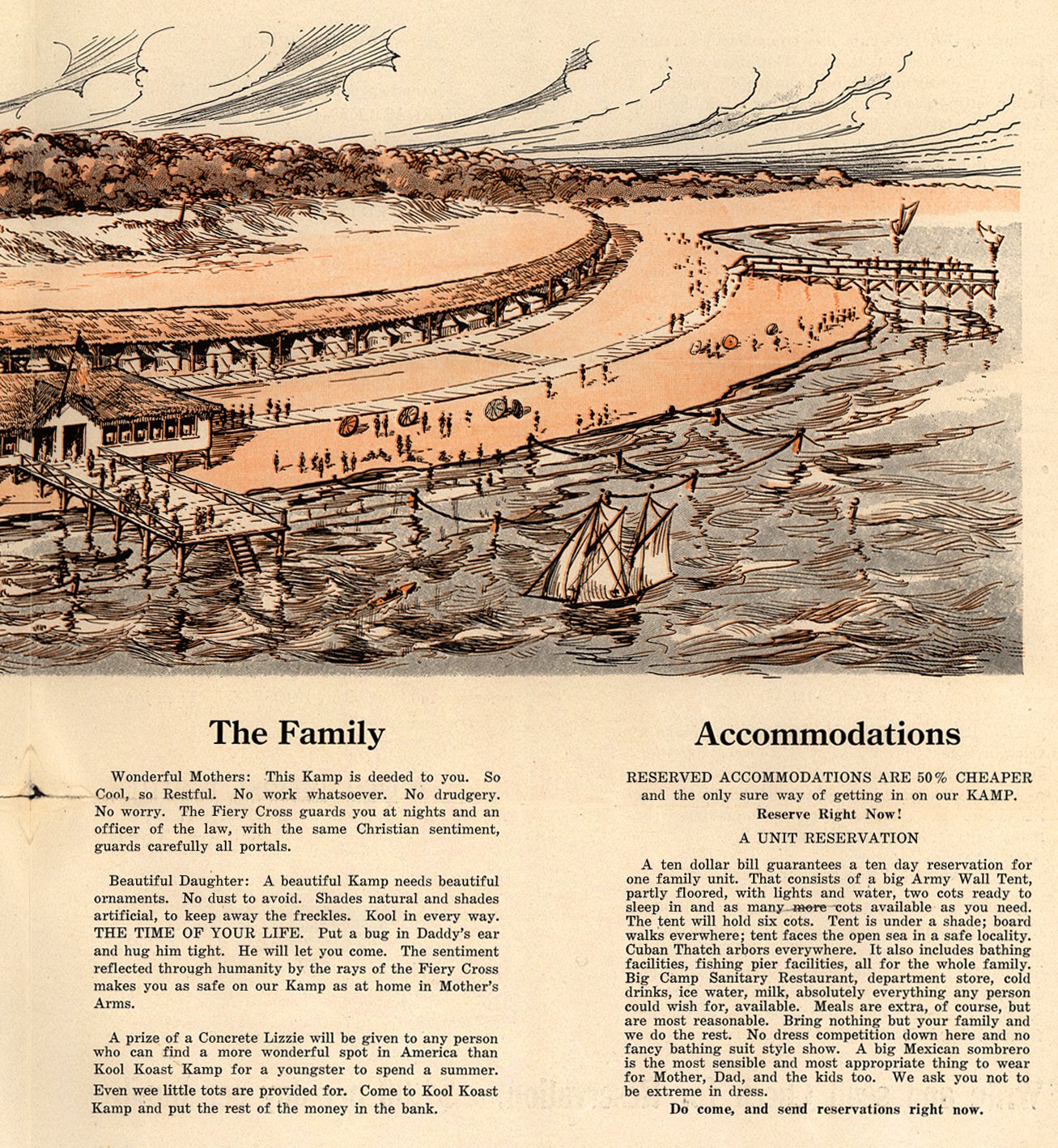
“No worry. The Fiery Cross guards you at night and an officer of the law, with the same Christian sentiment, guards carefully all the portals.”

As xenophobia takes a front row seat in American political culture, a bit of historical perspective is in order. In wake of WWI, the 1920s saw an explosion of anti-immigrant sentiment in the United States. This brochure, from the Duke University Library Digital Collectionpromotes a 1924 KKK Family Kamp near Rockport, Texas. 

As Kelly Baker notes in White Collar Supremacy:

Middle-class white supremacy had another wave of popularity in the 1920s, when the second Klan, which had a nationwide following, drew on the ideas of [Madison] Grant and others to sell white supremacy to both the rural and urban middle classes. It printed newspapers and books, held seminars as well as rallies, and even tried to establish a Klan university in Indiana.

Along with drumming up racial fears, the 1920s Klan relied on scientific and theological racism in The Imperial Night-Hawk, its national newspaper. Writing for the paper in 1923, a Louisiana Klansman and minister, W. C. Wright, outlined the Klan’s intellectual position on white supremacy, in which white people were “the leading race,” America was “a white man’s country, discovered, dedicated, settled, defended, and developed by white men,” and the distinctions between the races were scientific and divinely created.

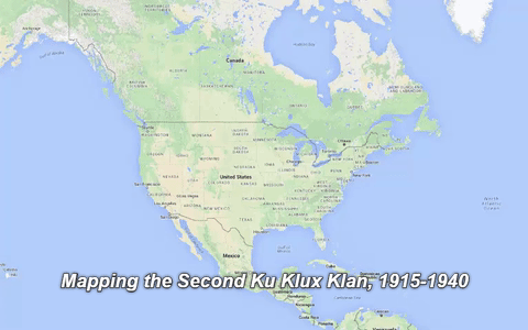
The second Klan spread quickly across America in the 1920’s. The VCU Libraries have documented its growth in a project, Mapping the Second Ku Klux Klan, 1915-1940

Each red dot shows a local unit or “Klavern.” The official numbers for each Klavern indicate a basic chronology for the chartering of the Klaverns, and they also reveal patterns of Klan organizing. This map invites you to learn about the second Klan in your area and across the U.S. and to study the courage of those who opposed the Klan.

timeline

To see more of what was driving KKK thinking, you can view a 1921 KKK application here.

Some of the KKK application questions echo today’s voices of fear and xenophobia: 

4. Where were you born?
5. How long have you resided in your present locality?
7. Were your parents born in the United States of America?
8. Are you a gentile or a jew?
9. Are you of the white race or of a colored race?
10. What educational advantages have you?
11. Color of eyes? Hair? Weight?
12. Do you believe in the principles of a PURE Americanism?
13. Do you believe in White Supremacy?
15. What is your religious faith?
17. Of what religious faith are your parents?
19. Do you honestly believe in the practice of REAL fraternity?
20. Do you owe ANY KIND of allegiance to any foreign nation, government, institution, sect, people, ruler or person?

Learning from Sea Monsters

I’m fascinated by old maps, so it’s been especially fun to follow the #MapMonsterMonday hashtag started by the Boston Public Library on Twitter and Instagram. Both have become hashtags for others to upload imaginative creatures.

Here’s a 5-minute PRI interview with Dory Klein, education assistant at the library’s Norman B. Leventhal Map Center. She started #MapMonsterMonday because “I wanted to connect people with our collections and make these maps a little more accessible and a little more fun. … They’re beautiful and fascinating and the stories behind them can turn into just a wonderful rabbit hole of research.”

If you’re looking for a great Map Monster lesson, I  recommend Medieval Maps and Monsters by the education team at the Osher Map LibraryIt’s a fascinating lesson for grades 3-5, but also  filled with resources for older students. It includes an editable PowerPoint presentation 16MB ppt, Sea Monsters Handbook 4MB pdf and even materials to make a Dangers of Sea Exploration Board Game. You also find links at Osher Map Library to other great map-based lessons on medieval maps, Renaissance, colonialism, thematic maps and more.

ortelius-handbook-sea-monsters


Feature image from (Ortellius, 1573) Instagram post by American Geographical Society Library

How To Teach EdTech to Future Teachers

I’ve been asked to pilot a new edtech class this spring for undergraduate ed majors in University of Portland’s School of Education. I’m still in the brainstorm phase and I thought I’d like to share some of my initial thinking.

First off  – a few things that I don’t want to do:

  • Oversell edtech. Too often educators try to force the latest edtech tool into the classroom because they think it’s cooler. Faster. Shinier.
  • Focus on teaching apps. Oh how I hated being forced to sit in a computer lab and suffer though PowerPoint professional development as a teacher. When I need students to use a specific app, I typically create a YouTube channel of short screencast how-tos. Or students can use the University’s Lynda account for more.
  • Take sides in the platform / device religious wars. These students will end up teaching in different settings, each with it’s own unique edtech landscape. They’ll need to be able to use what ever they find in their placements.

Instead I’d like to first “teach” adaptability – the mindset that’s helped me navigate the ever-changing edtech environment since I began my career in the early ’70s – an era of filmstrip projectors, 16mm movies and ditto machines. I’ve always thought first about my instructional goals, then tried to leverage whatever resources I could find to reach them. That calls for flexibility and a willingness to figure things out on your own. I couldn’t wait around for some school-sponsored PD.

A second, equally important goal would be to teach critical evaluation of the intersection of good instruction and technologies. A good teacher is skeptical, always re-assessing what’s working and what’s not. That’s especially important in the dynamic edtech world.

I envision a problem-based approach where I layout a series instructional challenges (opportunities?) and invite student teams to come back with a plan for achieving the goal using as much or as little technology as they saw fit. They would be expected to find a way to share their work in or out of class (why not flip that as well?) We would then go though a group evaluation, reflecting on what worked and what didn’t. Was the juice worth the squeeze? Move on to the next instuctional challenge. Reflect, rinse, repeat.

Here’s how I thought I might open my first class:  “Good instructional often begins with a pre-assessment. This is an edtech class, so as a starting point we need to get sense of where everyone resides on edtech landscape.”

  • What would be useful to know?
  • How should we gather that info?
  • How do we store and share (represent) what we find out?
  • Would any digital technologies be useful in this task? If so, which ones?
  • How do we set that up so that your peers can be successful participants?

Brainstorm over: Any thoughts on this approach? Anyone else out there teaching an edtech course and care to share?

Image Credit: Civilian Conservation Corps, Third Corps Area, typing class with W.P.A. instructor ca. 1933
National Archives and Records Administration Identifier: 197144

Tell Then and Now Image Stories with JuxtaposeJS

Created with two archival photographs
Tom Torlino – a student at Carlisle Indian School, 1882 and 1885.
More about Tom at my post on Medium.
Pro tip: get the eyes aligned

I’m excited about JuxtaposeJS – a new free web-based “storytelling” tool from the Knight Lab at Northwestern University. As they describe it: “JuxtaposeJS helps storytellers compare two pieces of similar media, including photos, and GIFs. It’s ideal for highlighting then/now stories that explain slow changes over time (growth of a city skyline, regrowth of a forest, etc.) or before/after stories that show the impact of single dramatic events (natural disasters, protests, wars, etc.).”

I think it’s a great tool for students and teachers who want to explore themes of continuity and change. While it could be used to compare and contrast in subjects across the curriculum, I’ve created a few examples using historical content.

I selected pairs of historical and contemporary images with elements that are consistent and aspects that change. But the challenge is to size and crop the images so that the consistencies align. To accomplish that, I used another free tool – Google Slides – to position and crop each pair of images and export as JPGs before importing into JuxtaposeJS. (Scroll to the bottom of this post for my workflow video that illustrates each step of the process.)

 
Timeline slider

Created with archival photograph paired with a screenshot I took from Google Street View.
Portland Ore Engine No 2 – 510 NW 3rd Ave.
Pro tip: choose a historic image that is shot from an angle similar to Street View. Street View is made up of a series of still images. You may need to navigate slightly on the street to get a shot that matches. Street View has been shooting for years. Use the drop down timeline (highlighted here) in upper left of Street View that has the angle and lighting that works best for your Juxtapose

Archival photograph of paired with photograph I took in the same location.
Taylor Hotel entrance Circa 1920
Pro tip: bring along a print out of historic photo to line up you new shot. Maybe you’ll get lucky (like I did) and find a SUV parked in the right spot. 

Here’s a video that details my workflow for this project
You’ll see how I used the transparency feature in Google Slides to create two well-aligned images that I imported into JuxtaposeJS via Dropbox. JuxtaposeJS supports both vertical and horizontal sliders. Pick the orientation that does a better job of concealing or revealing the continuity and change. Once the images are “published” at JuxtaposeJS they can be imported into your web via an iFrame embed as I have done in this post.

Image credits:
Tom Torlino
Portland Ore Engine No 2
Taylor Hotel Entrance. 347 SW 3rd Ave Portland Oregon Courtesy of Oregon Nikkei Legacy Center ONLC 533