Teach with Alternative Histories

First off – big shoutout to Jamie Clark – A talented educator to follow on Twitter @XpatEducator. See his collection of Teaching & Learning Resources. (Lots of great free downloadable templates.). I used one of his templates as the basis for this lesson

Here is a repost of the lesson I assigned my University of Portland pre-service teachers. Original here.


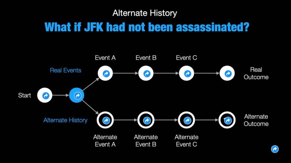
In honor of the historic nature of the 2020 election, students will have the opportunity to explore historical turning points and their own creativity by designing an alternative history. Students should have fun with this. It could be set in any era or region of the world. 

You should embed the slide show in a post. Include at least an explanation on why you feel this event was a historical turning point. 

Click here to make a copy and then modify.

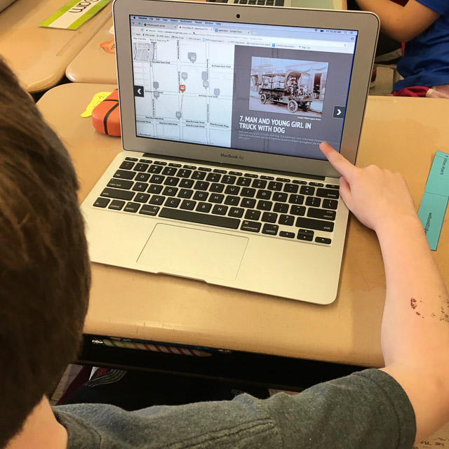
Student Work from this assignment.

I got very positive feedback from students who really enjoyed this lesson. They also thought it could be easily expanded so that students had to defend their alt histories. Another ideas was for the teacher to assign everyone the same real events and let students focus on creating and defending their own alt histories.

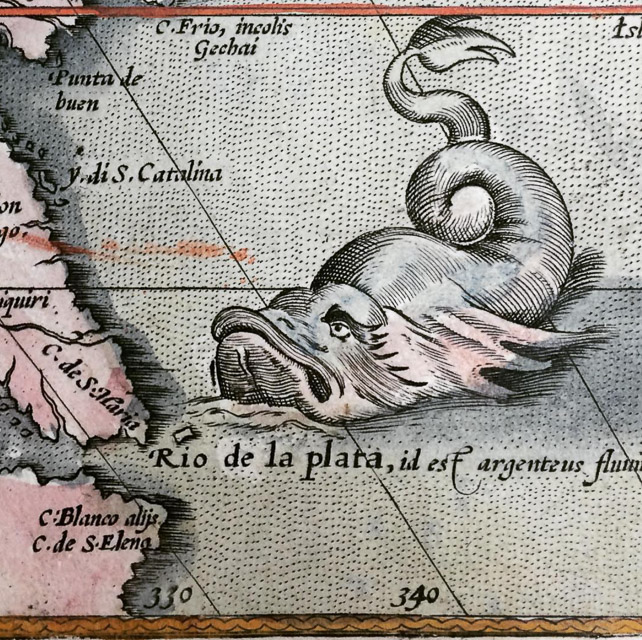
Here’s a few of the alt histories my students created.


Resources

HOW TO PREPARE YOU GOOGLE SLIDE FOR EMBEDDING ON BLOG POST
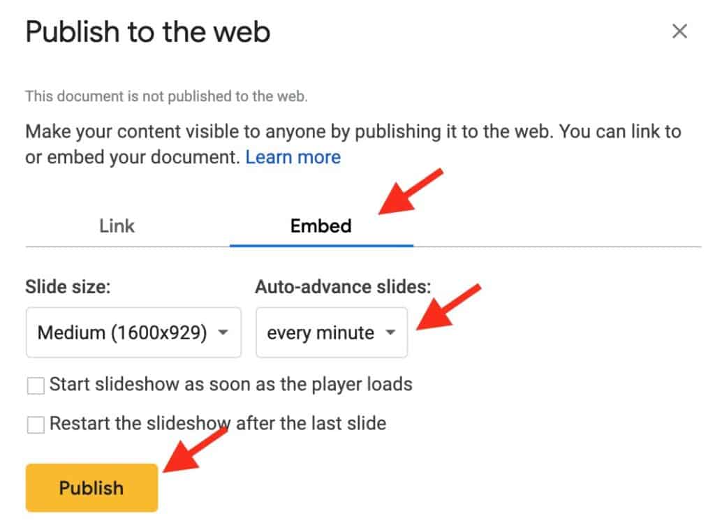
  1. Once you have finished slide show. Set Share to “Anyone with a link can view.”
  2. On toolbar click “File/Publish to web.”
  3. Click on embed
  4. Set “auto-advance” to every minute. (That will give viewer chance to navigate.)
  5. Click publish and you will get embed code to use with HTML Snippets.

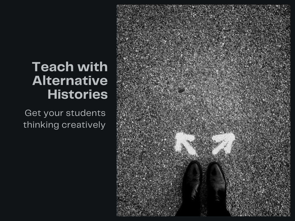
Featured image by Jon Tyson on Unsplash

Fight Racism with VR

Fight Racism with VR

These virtual and augmented reality programs allow the user to shift their point of view and experience the legacy of segregation in America. Students and teachers can “step inside” these immersive environments and feel the weight of systemic racism. These cutting edge approaches can inspire the next generation in America’s fight for social justice.
Descriptions by creators.

I am a Man VR

I Am A Man” VR Experience is an interactive virtual reality experience set to the historic events of the African- American Civil Rights Movement. Users will witness the 1968 Memphis Sanitation Worker’s Strike and the events leading to the assassination of Dr. Martin Luther King, Jr. using the Oculus Rift VR headset. The VR project was created by Derek Ham and won an award for funding through the Oculus Launch Pad program.

Traveling While Black

Traveling While Black is a cinematic VR experience that immerses the viewer in the long history of restriction of movement for black Americans and the creation of safe spaces in our communities.

Academy Award winner Roger Ross Williams and Emmy Award-winning Felix & Paul Studios’ film transports you to historic Ben’s Chili Bowl in Washington DC. The viewer shares an intimate series of moments with several of the patrons of Ben’s as they reflect on their experiences of restricted movement and race relations in the U.S.

1,000 Cut Journey


1,000 Cut Journey is an Immersive Virtual Reality experience in which participants embody a Black male, Michael Sterling, experiencing racism as a child through disciplinary action in the classroom, as an adolescent encountering the police, and as a young adult experiencing workplace discrimination.

Mapping Amache

Mapping Amache: The Amache Internment Camp is located near Granada, Colorado. It is where over 10,000 Japanese-American citizens and persons of Japanese ancestry were forced to live from 1942-1945. It is also called Granada Relocation Center.

This weblog is intended to follow along with the long-term project of mapping this one square mile of earth where so much history took place. The basic map of Amache has been developed over the last few years. There are layers for things like roads, boundary, housing blocks, barracks and so forth. The challenge is to present this information in a way that makes it useful, accessible and honors the people who lived there.

Featured image credit
Girl at the March on Washington with Banner 8/28/1963
National Archives National Archives Identifier: 542030

Tour Japantown PDX with StoryMapJS and JuxtaposeJS

Northwestern University Knight Lab has produced some great free storytelling tools. I’ve previously posted about comparing images using JuxtaposeJS. It’s great for telling then and now stories when you have a good balance of continuity and change. Here’s a example of frame comparison I made using the tool. Use your mouse to grab the slider and move it up and down.

It shows one of Portland’s Japanese owned/managed hotels back in the heyday of Portland’s Japantown before the forceable removal and incarceration of its citizens during WWII. More on how to create with JuxtaposeJS

Another KnightLab tool is StoryMapJS, a free tool to help you tell stories on the web that highlight locational content. I’ve been playing around with StoryMap and thought it might be fun to see if I could embed JuxtaposeJS sliders into a StoryMap. I think the integration worked well – though it is better viewed from this direct link on your desktop / mobile device than in the embed below. (This embed messes a bit with the size of the feature photos.) As you go though the tour you’ll see I used a mix of static photographs and image blends I made with JuxtaposeJS.

I had lots of great content from my multi-touch book Portland’s Japantown Revealed. It featured engaging then / now photo widgets that allow the user to “paint” history into contemporary photos with a wipe of their finger. So I reused the then / now photo comparisons using the a different tool – JuxtaposeJS and then used them for image content in the StoryMap. Note: Historic images are supplied by Oregon Nikkei Legacy Center. I took the contemporary photos.

Backstory:  I was scheduled to visit Marisa Hirata’s 3rd graders at Portland’s Alameda Elementary School. Students had been researching Portland’s Japantown and had already designed a “shoebox” replica of the community. For my visit, I created this StoryMapJS “tour” and the students used each stop as writing prompts.  This StoryMap was great for helping students to visualize how people’s lives were lived in Portland’s thriving pre-WWII “Nihonmachi.”

Learning from Sea Monsters

I’m fascinated by old maps, so it’s been especially fun to follow the #MapMonsterMonday hashtag started by the Boston Public Library on Twitter and Instagram. Both have become hashtags for others to upload imaginative creatures.

Here’s a 5-minute PRI interview with Dory Klein, education assistant at the library’s Norman B. Leventhal Map Center. She started #MapMonsterMonday because “I wanted to connect people with our collections and make these maps a little more accessible and a little more fun. … They’re beautiful and fascinating and the stories behind them can turn into just a wonderful rabbit hole of research.”

If you’re looking for a great Map Monster lesson, I  recommend Medieval Maps and Monsters by the education team at the Osher Map LibraryIt’s a fascinating lesson for grades 3-5, but also  filled with resources for older students. It includes an editable PowerPoint presentation 16MB ppt, Sea Monsters Handbook 4MB pdf and even materials to make a Dangers of Sea Exploration Board Game. You also find links at Osher Map Library to other great map-based lessons on medieval maps, Renaissance, colonialism, thematic maps and more.

ortelius-handbook-sea-monsters


Feature image from (Ortellius, 1573) Instagram post by American Geographical Society Library

Where I’m From: Using Haiku Deck to Visualize Place

Where-Im-fromHere’s a lesson I designed for use in my University of Alaska Southeast summer course – ALST 600. I’ll be working with nearly 40 preservice teachers in the secondary MAT program teaching Alaska Studies using a place-based approach that integrates good instructional practice and free ed tech tools across the curriculum. For more on this lesson click here

This lesson features a poem as a prompt for a creative reflection. It also integrates two tools for presentation of the reflection.

  1. After reading Where I’m From, students will use Haiku Deck to design a brief presentation that uses text and images to depict “where they are from.” The presentation should include a a title slide plus 6 slides which explore the place you’re from. Follow this link for ideas on Where to Go with “Where I’m From”
  2. After completing the Haiku Deck presentation, students will create a blog post that includes an embedded version of the presentation and a written response to the question:

What have I learned from this activity and how might I use the learning strategies and / or technology in my teaching placement?

Where I’m From” by George Ella Lyon

I am from clothespins,
from Clorox and carbon-tetrachloride.
I am from the dirt under the back porch.
(Black, glistening,
it tasted like beets.)
I am from the forsythia bush
the Dutch elm
whose long-gone limbs I remember
as if they were my own.

I’m from fudge and eyeglasses,
from Imogene and Alafair.
I’m from the know-it-alls
and the pass-it-ons,
from Perk up! and Pipe down!
I’m from He restoreth my soul
with a cottonball lamb
and ten verses I can say myself.

I’m from Artemus and Billie’s Branch,
fried corn and strong coffee.
From the finger my grandfather lost
to the auger,
the eye my father shut to keep his sight.

Under my bed was a dress box
spilling old pictures,
a sift of lost faces
to drift beneath my dreams.
I am from those moments–
snapped before I budded —
leaf-fall from the family tree.